


Laird Precinct, Phelps County, Nebraska
About
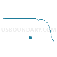
Outline

Summary
| Unique Area Identifier | 613701 |
| Name | Laird Precinct |
| County | Phelps County |
| State | Nebraska |
| Area (square miles) | 41.92 |
| Land Area (square miles) | 41.84 |
| Water Area (square miles) | 0.08 |
| % of Land Area | 99.80 |
| % of Water Area | 0.20 |
| Latitude of the Internal Point | 40.47785030 |
| Longtitude of the Internal Point | -99.47897400 |
Maps


Graphs
Select a template below for downloading or customizing gragh for Laird Precinct, Phelps County, Nebraska


Neighbors
Neighoring Voting District (by Name) Neighboring Voting District on the Map
- Garfield-Union Precinct, Phelps County, NE
- Prarie and Sheridan Precinct, Phelps County, NE
- Rockfalls-Industry Precinct, Phelps County, NE
- Westmark-Center Precinct, Phelps County, NE
Top 10 Neighboring County Subdivision (by Population) Neighboring County Subdivision on the Map
- Laird township, Phelps County, NE (529)
- Garfield township, Phelps County, NE (528)
- Union township, Phelps County, NE (477)
- Prairie township, Phelps County, NE (370)
- Industry-Rock Falls township, Phelps County, NE (238)
- Sheridan township, Phelps County, NE (196)
- Center township, Phelps County, NE (187)
- Westmark township, Phelps County, NE (173)
Top 10 Neighboring Place (by Population) Neighboring Place on the Map
Top 10 Neighboring Unified School District (by Population) Neighboring Unified School District on the Map
- Holdrege Public Schools, NE (6,994)
- Bertrand Public Schools, NE (1,433)
- Loomis Public Schools, NE (788)